Technology

The AEROKATS project is constantly updating technology and tools to meet the unique research needs of participants. engaging way. Detailed below is more information on how each subject is showcased in the program.

Technology

The AEROKATS program utilizes kites as a science platform for capturing data and images from an aerial perspective. The kites carry a NASA patented technology (Patent # US 8,196,853 B2) called Aeropods that keep the instruments stable and aligned with the wind during flight. AEROKATS utilizes a large catalog of kites and Aeropods to capture a variety of data for use in both scientific research and education.

Diagram of Aeropod attached to kite line

Kites

Why Kites?

  • Kites are an accessible and affordable method for gaining an aerial perspective.
  • Observation techniques similar to those in use on NASA spacecraft and aircraft can be easily demonstrated and explored.
  • The kite’s “Birds-Eye” vantage point from above is beneficial for many of NASA’s Earth science research activities.  Kites are well suited for local-scale observations by a wide variety of users.
  • Teamwork and fun are embedded in AEROKATS kite flights, promoting a unique and meaningful learning environment.

The left kite is called an Alpine DC. It is one of  the “workhorse” kite models because it is capable of carrying the various AeroPods in flight. While the Alpine is the most expensive kite, it is the most reliable for flying in low to medium wind speeds.

The left Parafoil 10 can also carry an AeroPod. It flies best when the winds are medium to high speeds and constant. Because there is no support structure in the kite, if the wind speed is variable it has the potential to collapse on itself and fall from the sky.

The right kite is called a 9ft Delta. This kite and the 7ft Delta are both capable of carrying AeroPod payloads. They fly stably at most wind speeds, but are more suited than the Alpine for higher wind speeds.

 The right Frustrationless Flyer kites are great introductory kites. They fly well in a lot of different environments which allows students to practice safe flying techniques. They arrive as kits for assembly and decoration by students.

Aeropods

Aerodynamically stabilized instrument platform

The AeroPod is a passive device that uses aerodynamic forces to stabilize an instrument package suspended from a kite or tethered blimp. It is a low-altitude custom remote sensing platform craft designed for, but not limited to, agricultural and environmental research purposes. AeroPods can be used for a variety of remote sensing and in-situ observations.

Benefits:
  • Light weight, simple to construct, and has no moving parts.
  • Can be used for a variety of remote sensing and in-situ observations.
  • Able to accommodate many different-sized instruments, even bulky ones.
  • Offers a low-cost alternative to other remote sensing and observation techniques.
Image of Monocam Aeropod with parts identified
Parts List:
  • Boom: Holds all the components in place
  • Fins + Fin Clips: keeps the Aeropod directionally oriented into the wind
  • Camera Mount*: Allows for adjustment of the viewing angle of the camera
  • Pylon: Attaches leader line to the Aeropod and balances Aeropod around the center of gravity
  • Leader line + Hanger: Attachment between the Aeropod and kite line
    *Aeropods are a platform for mounting various instrumentation weighing roughly under a pound, and not just cameras

There are primarily two types of data collected with the various instrumentation flown on Aeropods, aerial imagery and atmospheric profiles. Below is detailed several instruments that are used regularly in the project and they reflect different price points and fidelity of data based on the user’s budget and research needs.

GitUp 2 Pro camera mount on the front of an aeropod

Aerial Imagery

Aerial Imagery Aeropods are used to collect images and video. The data can be used for exploration as simple as graining and understanding of the remote sensing perspective or identifying objects from afar to the more challenging realm of image classification and green leaf indexing.

Kestrel 5500 weather profiler attached to the front of an aeropod

Atmospheric Profiles

Atmospheric Aeropods are used in flight to capture profiles of data as the instrument ascends and descends through the atmosphere. They also have applications in recording small scale (temporal and scalar) atmospheric data, as well as, capturing localized atmospheric phenomenon.


Aerial Imagers

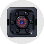
The Sir Gawain G007 captures video footage in the visible range. Frames can be captured from the video footage to create pictures.

The Sir Gawain camera is a less expensive option that provides a great introduction to capturing remotes sensing data.

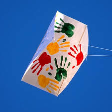
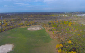
Below is an example of an image captured with the MiniCam:

minicam picture

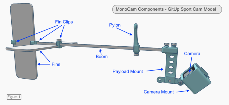
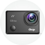
Gitup cameras capture visible images. The camera can be configured to capture images every couple seconds to gather a series of images that can later be stitched into larger map.

The MonoCam camera options are constantly evolving as new imagers become available and others are discontinued.

Below is an example of an image captured with the MonoCam:

Aerial view of baseball diamonds and woods.

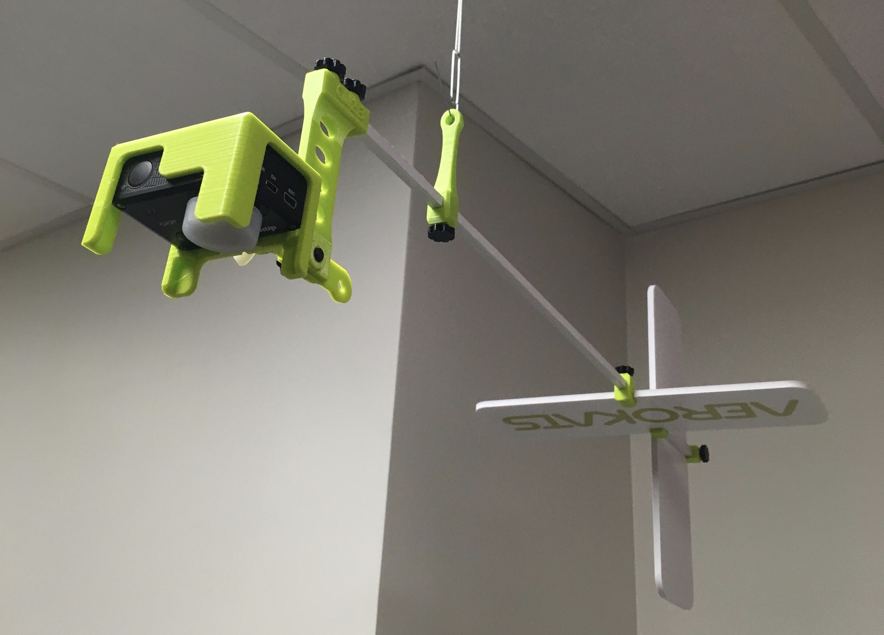
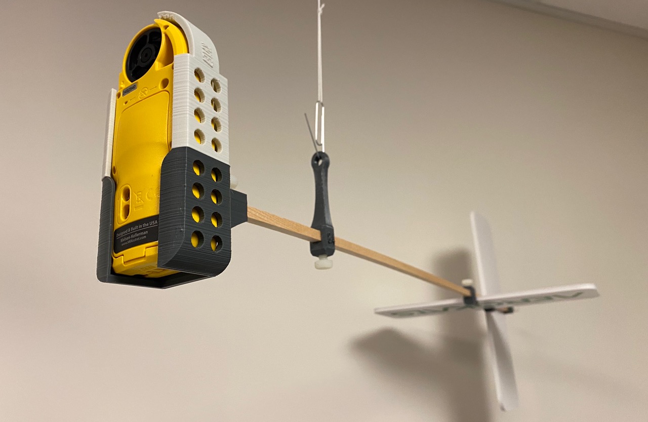
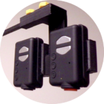
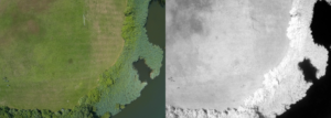
The TwinCam captures near simultaneous images in in both visible and near infrared and can be configured to capture images every couple seconds. With both visible and near-IR images it’s possible to use image processing software to perform image classification, or vegetation indexing for example. This allows us to measure impervious surface, or  vegetation health productivity.

This TwinCam model consists of two Mobius-1 Action Cameras, one modified to view only Near Infrared light.

Below is an example of images captured with a TwinCam:

Side by side images of visible and near-infrared of a grassy field bordered by water

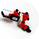
The VideoPod simultaneously records video footage and transmit it to a receiver on the ground so the video can be viewed in flight. The VideoPod uses Tactic brand cameras, 5.8 GHz transmitters
and receiver/monitor/dvr units. The airborne camera and transmitter are powered by a 9 volt alkaline battery, using about 1 watt of power. This gives about an hour of line-of-sight video at a maximum range of
~500 feet to the ground based receiver/monitor/dvr.


Atmospheric Profilers

Kestrel Drop Specs:

  • Ambient Temperature
  • Relative Humidity
  • Pressure
  • Density Altitude
  • Dew Point
  • Heat Index

Pocketlab Weather Specs:

  • Temperature (Probe)
  • Temperature (Ambient)
  • Barometric Pressure
  • Altitude
  • Light Intensity
  • Humidity
  • Dew Point
  • Heat Index

Kestrel 5500 Specs:

  • Wind Speed
  • Ambient Temperature
  • Relative Humidity
  • Pressure
  • Compass
  • Air Density
  • Air Flow
  • Altitude
  • Barometric Pressure
  • Crosswind
  • Density Altitude
  • Dewpoint

Atmotube Specs:

  • TVOC
  • PM 1, 2.5, 10
  • Temperature
  • Pressure
  • Humidity

Software Tools

AEROKATS utilizes a variety of tools to analyze the data captured from flights and the majority of tools are open access. These tools allow users to manipulate images and extract more meaningful information out of the data

CODAP
Common Online Data Analysis Platform is a free web program that aids users in analyzing data from excel files

QGIS
QGIS is geographic information system (GIS) software that allows users to analyze and edit spatial information, in addition to composing and exporting graphical maps.

MultiSpec
MultiSpec is an image processing tool to display and analyze geospatial images

MapKnitter
Public Labs tool for combining and positioning images in geographic space into a composite image map

Infragram
Public Labs tool for analyzing plant health with near-infrared imagery

Image Sequencer
Public Labs tool for image processing. Each modification makes a new copy of the image, resulting in a series of images showing each step

Loading...