Use Cases
Meteorological Effects on Renewable Energies
Students at Toledo Technology Academy of Engineering alongside instructor Laura Kubiak conducted a variety of missions to learn about meteorological impacts on alternative energies
The students designed their own research inquiry utilizing both GLOBE protocols and AEROKATS technology and procedures to study the effects of atmospheric influences on solar and wind energy efficiency. One student, Corrine, utilized the Aeropod system with atmospheric profiling instrumentation to collect barometric pressure readings in conjunction with the GLOBE cloud coverage protocol to better understand the relationship between atmospheric pressure and cloud development and how that impacts solar energy collection.
A Study in Microscale Weather Data
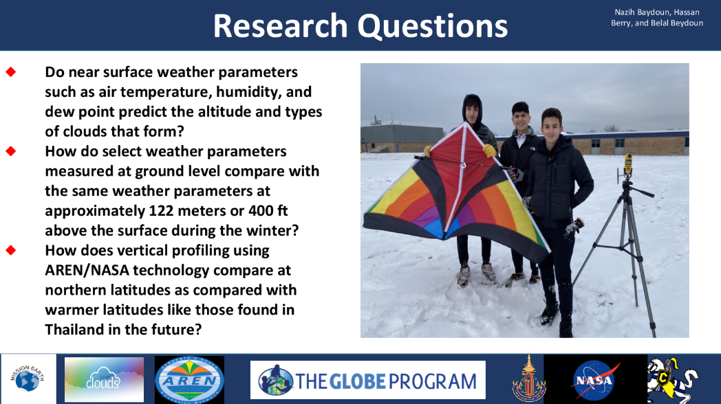
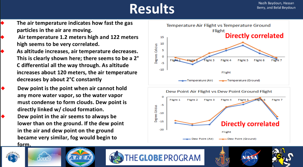
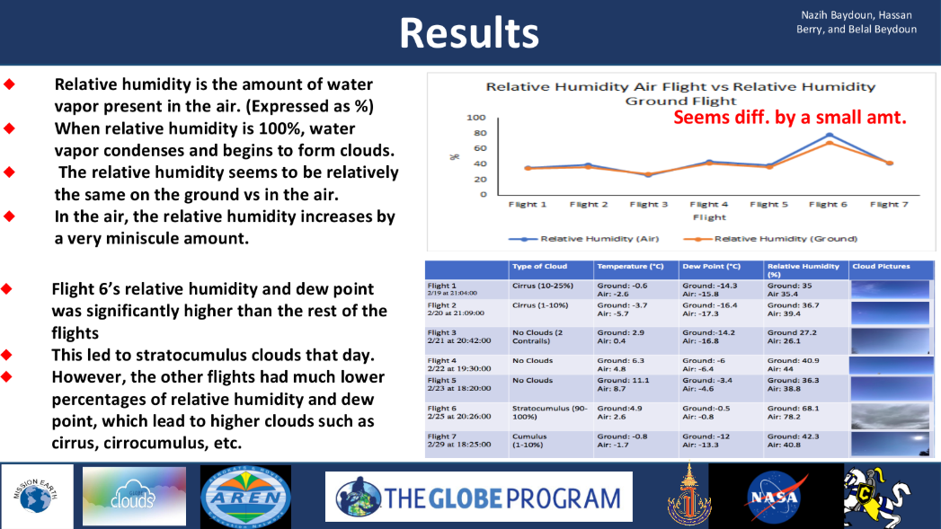
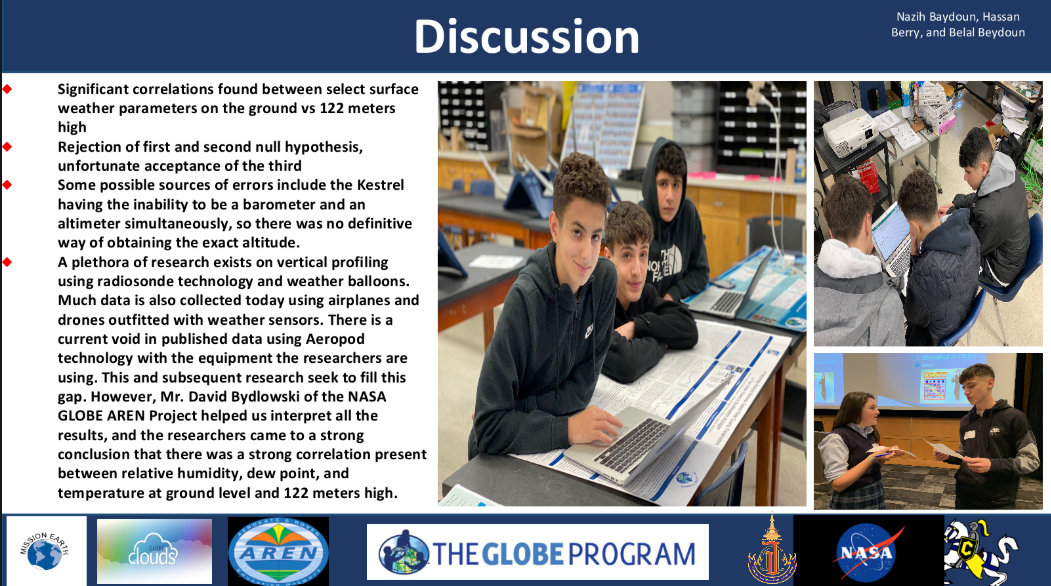
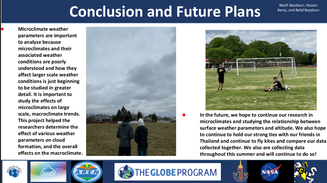
Students at Crestwood Highschool did a qualitative comparison of weather data measured on the ground verses at altitude using an Aeropod with atmospheric profiling instrumentation.
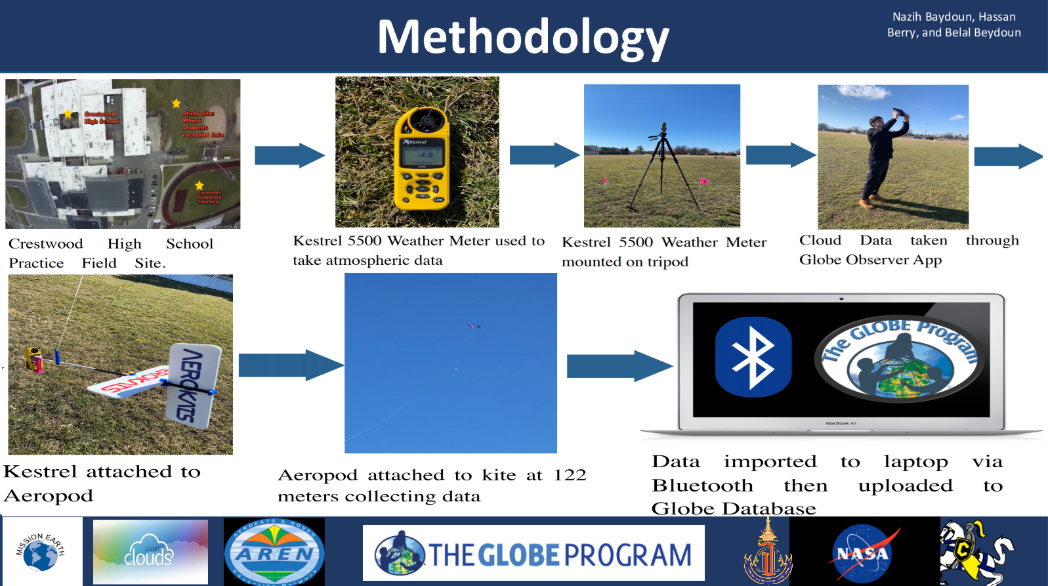
Students did simultaneous measurements on the ground and at altitude using AEROKATS kite and Aeropod technologies and Kestrel 5500 weather instruments to do a comparison of temperature, dew point, and humidity. In addition to noting differences at altitude, the students also captured the phenomenon of adiabatic lapse rate as the temperature decreased with altitude. They were also able to draw a connection between dew point and humidity levels with altitude specific cloud formations by following the GLOBE cloud cover protocol at the time of flight.
Manual Image Classification
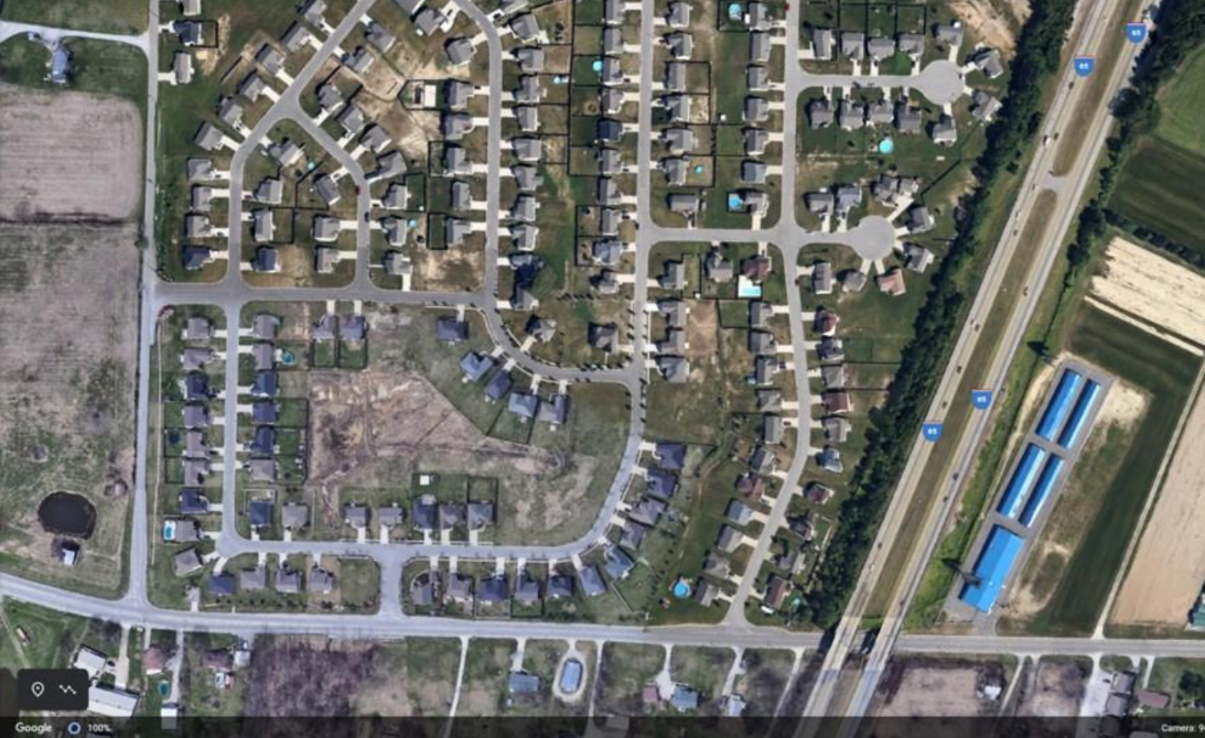
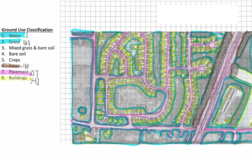
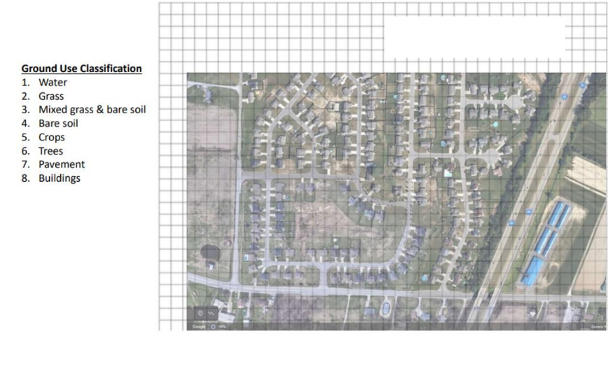
Students at Henryville High School created classified images from google map screen captured aerial images
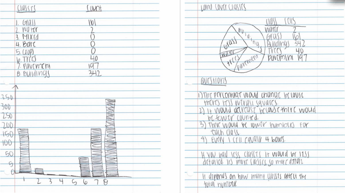
Students captured Google Maps aerial images of locations that held significance to them and then designated a certain number of land cover types to study. The result of the manual image classification was a classified image with specified landcover types as well as a table with the number of gridded squares for each landcover type. These numbers were then plotted in a bar graph or pic chart to show a graphical representation of landcover.



Kite Tail Comparison
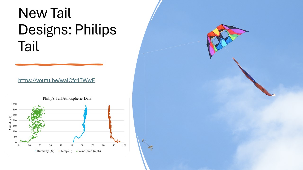
Kathleen McNamara and students at OSU conducted studies to test which kite tails aid the most in stable kite flight and designed novel kite tails for testing.
OSU undergraduate engineering students conducted a comprehensive study of kite tails to determine which tail performed best based on their defined criteria of transportability, maneuverability, stability, climb, and ease of use. These studies were collected using AEROKATS safety procedures and Atmospheric Profiling Aeropods. The students took the research objective one step further by applying their results to the design of novel tails which were testing in flight following the same criteria.